This tool is designed to aid you in researching your flood risk in the state of Maryland.
Content on this site is typically updated with in a 30 days of any maps or data released by FEMA, so please check back as the status of your county may have changed.
It is important to investigate your flood risk status and contact your insurance agent to make the necessary modifcations to your coverage.
A schedule for tentative county effective dates can be found here.
Email questions or comments to flood.maps@maryland.gov
How to use the application:
Find your address:
Enter an address into the "Find a place" box on this page to zoom to the closest match.
- or -
Select the county you are interested in from the "zoom to county"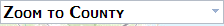 drop down box.
- or -
Select the "Target" icon to zoom to the location in which you are currently accessing the internet from.
- or -
In or out
 icons or a scroll mouse may be used for zooming your view down to a street or neighborhood level.
After locating your area of interest, select the "Determine Flood Status" tool and click the desired location on the map. Results for the selected location will display in the details tab.
In the event you are unable to navigate, please select the "Help" link in the upper right hand corner to display the navigation directions.